
Key Takeaways
- Survey control works best as an ongoing process, not a one-time preconstruction task.
- Checking location, grade, and alignment before permanent work is installed can limit avoidable rework.
- Current plans, stable control points, and clear field records keep trades working from the same information.
- The right instrument depends on the task, the site conditions, and the required level of detail.
- Independent verification is especially useful before concrete, finishes, or backfill conceal the work.
At active construction sites in Nassau County, a layout error can quickly escalate from a minor field issue to a costly coordination problem. Tight lots, busy access routes, existing utilities, and fast-moving trade schedules leave little room for assumptions. Planned survey checkpoints give contractors and property owners a practical way to confirm critical work before the next phase makes corrections more difficult. For projects that require local layout and verification support, Precision Surveys provides construction-focused services, including property stakeouts, foundation locations, access lines, final surveys, and as-built work. Its construction survey Nassau, NY, service page reflects the type of field support used on projects across Nassau and Western Suffolk, as well as the Five Boroughs, where licensed survey experience and responsive documentation can help teams work from dependable control.
Why Survey Checkpoints Matter on Active Job Sites
A single survey performed before construction begins does not automatically protect every later phase. Excavation, deliveries, equipment movement, weather, design revisions, and changing site access can affect stakes, benchmarks, and field assumptions. A checkpoint schedule creates intentional moments to verify the work against the latest approved information. Consider a foundation wall placed slightly outside its intended location. The discrepancy may seem manageable at first, but it can affect framing dimensions, utility clearances, exterior setbacks, openings, and drainage details. Confirming the wall lines and elevations before concrete placement gives the project team a chance to address an issue while options are still available.
What a Construction Survey Checkpoint Includes
Construction surveying provides dimensional control for the many stages that turn plans into completed work. A useful checkpoint is more than a stake in the ground. It should connect field measurements to an organized, repeatable project record.
- Known horizontal control points tied to the project coordinate system.
- Reliable elevation benchmarks used to transfer grades and floor levels.
- Property lines, setbacks, building offsets, and approved work limits.
- Locations for foundations, columns, slab openings, utilities, and access features.
- Field notes, photographs, measurements, dates, and the drawing revision used.
Five Times to Schedule a Survey Check
1. Before Excavation
Confirm property limits, proposed building position, setbacks, and site control before excavation changes the ground surface. Establish backup points away from traffic and active digging where practical.
2. Before Foundation Work
Verify footing lines, corners, offsets, key elevations, and anchor or hold-down locations. This is a critical point because concrete can lock in an error that influences the entire structure.
3. Before Framing or Structural Placement
Check column lines, floor edges, major openings, and structural reference lines. A clear layout helps framing and steel crews identify issues before materials are permanently connected.
4. Before Utility Installation
Confirm utility routes, connection points, slopes, and elevations against current plans. This is particularly important where new work must fit around existing site features or previously installed systems.
5. At Project Closeout
Document completed conditions through an as-built survey or other required verification. Closeout records can help owners, designers, contractors, and future maintenance teams understand what was installed.
How Survey Checkpoints Reduce Rework
Verification is most valuable before work is covered. For example, a slab opening that is shifted from its planned position may affect a drain, equipment pad, stair, or future utility penetration. Identifying the shift before the pour is generally simpler than modifying finished concrete after other trades have begun work nearby. Repeated checks also help after conditions change. Heavy equipment can disturb markers, grading can alter reference conditions, and revised drawings can change dimensions that crews previously relied on. Documented measurements give project managers a clearer basis for decisions than memory, informal tape measurements, or unverified assumptions. Industry discussion of digital field workflows also emphasizes the value of connecting accurate survey data with timely field verification.
Choosing the Right Tool for the Task
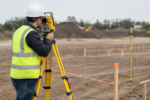
- Total stations are well-suited to detailed building layout, angle measurement, and work where line-of-sight control is available.
- GNSS equipment can be useful for open-site work, broad grading, and establishing positions where satellite reception is suitable.
- Digital levels help transfer and check elevations with consistency.
- Conventional measuring tools remain useful for quick field checks, but should not replace established control for critical layout.
Equipment is only one part of accuracy. The project also needs sound control, correct units, current drawings, and a field professional who understands what must be confirmed.
A Simple Field Process for Better Accuracy
- Review the latest approved plans before mobilizing.
- Confirm the coordinate system, units, and relevant benchmarks.
- Inspect existing control points for movement, damage, or obstruction.
- Set or verify backup control away from excavation and delivery routes.
- Check high-consequence points from more than one position when practical.
- Record the measurements, date, personnel, and drawing revision used.
- Share clear results with the superintendent, project manager, and affected trades.
Common Mistakes That Weaken Survey Control
- Using an outdated plan set after a design change.
- Relying on a single control point without an independent check.
- Placing stakes where trucks, excavation, or material storage can disturb them.
- Failing to document grade changes or changed site conditions.
- Assuming another trade’s layout has been independently verified.
- Waiting until closeout to compare completed work with the design.
Questions to Ask Before Hiring a Survey Team
Ask which phases require layout or verification, how quickly the team can respond to field changes, and whether it will work from the current approved drawings. Also, ask how control points, field notes, and as-built information will be documented. Relevant experience with the project type, local site conditions, and required deliverables matters as much as the equipment brought to the job.
How to Build a Checkpoint Schedule
List each construction stage where a location, elevation, or alignment error could cause major rework. Match that stage with a specific survey task, identify who receives the results, and set expectations for routine versus urgent requests. Keep the records with the project documents, then revisit the schedule whenever the design, sequence, or site conditions change.
Conclusion
Construction survey checkpoints give Nassau County project teams a disciplined way to confirm the work before small errors become expensive problems. Regular checks of layout, elevations, boundaries, foundations, utilities, and other critical elements can help identify discrepancies while they are still easier to correct. Keeping current plans, stable control points, accurate field measurements, and organized survey records also gives contractors, engineers, and owners a clearer reference throughout the project. Timely communication is equally important when site conditions or measurements do not match the approved plans. By building survey checkpoints into each major construction phase, teams can reduce avoidable rework, support coordination between trades, and maintain better documentation from excavation through closeout. This structured approach can help Nassau County projects move forward with fewer surprises and clearer decisions in 2026.